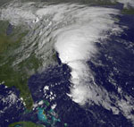
 The Geostationary Operational Environmental Satellite (GOES)-P represents a continuation of the newest generation of environmental satellites built by Boeing for the National Oceanic and Atmospheric Administration (NOAA) under the technical guidance and project management of NASA's Goddard Space Flight Center, Greenbelt, Md.
GOES satellites provide the familiar weather pictures seen on United States television newscasts every day. The GOES imaging and sounding instruments (built by ITT) feature flexible scans for small-scale area viewing in regions of the visible and infrared spectrum allowing meteorologists to improve short-term forecasts. GOES provides nearly continuous imaging and sounding, which allow forecasters to better measure changes in atmospheric temperature and moisture distributions and hence increase the accuracy of their forecasts.
GOES environmental information is used for a host of applications, including weather monitoring and prediction models, ocean temperatures and moisture locations, climate studies, cryosphere (ice, snow, glaciers) detection and extent, land temperatures and crop conditions, and hazards detection.
The GOES-O & P Imagers have improved resolution. The finer spatial resolution allows an improved cloud-top product, better information on atmospheric motion and volcanic ash detection. GOES-P continues the improved image navigation and registration, additional power and fuel lifetime capability, space weather, solar x-ray imaging, search and rescue, and communication services as provided on GOES-13 and GOES-14.
You have read this article Science
with the title GOES-P Mission. You can bookmark this page URL https://roxpolitix.blogspot.com/2010/02/goes-p-mission.html. Thanks!


No comment for "GOES-P Mission"
Post a Comment